
Linlithgow map: find the palace, station and canal
Linlithgow Palace · Last updated
Your bearings in Linlithgow
Find the palace, station and waterside stops, then use the numbered place list to plan your visit.
7 places shown
1. Linlithgow Palace
Roofless royal palace and grassed park beside the loch. Building entry has a ticket and historic stairs; park time is a separate choice.
Plan the palace2. Loch path
The operator lists a 2.3-mile circular gravel path. Choose a short section or a full circuit, with weather and current surface conditions in mind.
Read the walking guide3. Cross & Well
A central orientation point with civic stonework, near the route up towards the palace. Watch traffic and crossings around the centre.
Explore the Cross Well4. Rail station
Rail arrival point south of the historic centre. The station record lists step-free platform access; check the separate route and access needs for your destination.
Plan a train arrival5. Canal Centre
Canal and towpath south of the town centre. Public boat trips are seasonal; check departures separately from planning a towpath walk.
Check canal visit choices6. Parish church
Historic parish church beside the palace approach. A working place of worship with its own visitor opening arrangements, separate from palace tickets.
Plan a church visit7. Burgh Halls
Civic venue at the Cross. Check current public opening and event arrangements before making an indoor stop part of the day.
Read the halls guideNo place matches. Try a shorter search or show all places.
Read the operator's palace access advice and the station facilities before choosing a route.
Around Linlithgow
The wider area on one map: the palace in the middle, with the Firth of Forth to the north. Distances are straight-line from the palace, from OpenStreetMap coordinates, not driving or walking routes.
- 1Blackness Castle about 6.1 km from the palace
Coastal fortress on the Firth of Forth, a separate trip from the town centre.
Plan Blackness Castle - 2Linlithgow Bridge about 1.8 km from the palace
Village about 1.8 km west of the palace where the 1526 battle is placed. Check the route and pavements before walking it.
Read about the battle - 3Beecraigs Country Park about 3.2 km from the palace
Woodland park south of the town. Plan the journey separately: it is not a short walk from the station.
Read about the parks - 4Bo'ness about 4.4 km from the palace
Firth of Forth town north of Linlithgow, linked by the bus guide.
Check the Bo’ness bus
The short answer
Use this map to choose the next place in your day, not to navigate a road or prove a step-free route. The palace and loch sit north of the old centre.
Find the detail you need4
This Linlithgow map helps you place the palace, loch, station, Cross and canal in one town visit. It's a self-hosted schematic: north is up. The positions show the relationship between places rather than surveyed distances. Select a marker to read its complete visitor record. Search or filter the list to focus on history, outdoor places or transport.
Use the dated facts and figures for palace attendance, access figures and local opening information alongside this map.
How to use the Linlithgow visitor map
Choose a numbered marker or a record in the list. The marker takes you to the right record, where you can read the visitor limits and open the fuller guide. The number names a place, not a ranking or a walking order.
If filters are available, select a category to show the kind of place you need. Search checks the place names and short visitor guides. Reset returns the full set. A search with no match shows a message rather than a blank unexplained panel.
The map doesn't request your location or load outside tiles. It's designed to give a compact overview even without a live map service. If you need exact directions, safe crossings or road-closure details, use a current navigation source and signs on the ground.
Choose a connected visit
The station gives a town arrival point south of the centre. The palace and the Peel are on the loch side. The Cross links the central visitor places, while the canal gives a separate waterside setting to the south. Those relationships help you avoid treating each stop as a new long journey.
You can choose palace entry as the main visit, then add a short loch-side walk. Or you can make the town and canal the focus when you don't want to enter a building. A full loch circuit adds 2.3 miles beyond the route from the station and other stops, according to the site’s source for a visit.
The things-to-do guide weighs choices by time and weather, plus season. The map makes their relative positions clear. The guides carry the fuller access and booking questions.
Access and present-day conditions
A schematic can't show every slope, step or surface, plus crossing. The rail station’s listed step-free platform access doesn't show a step-free route through town or into the palace’s upper rooms. Read the current primary access sources for the needs that matter to your party.
The canal event list is seasonal, and public trips for the 2026 season were listed as closed at the review date. A map marker for the centre is not a claim that a boat is running. The same applies to the church and halls: their location doesn't show today’s indoor opening.
Print and use the place list
The print view retains all place records, even if you have used a filter on screen. It also keeps the schematic’s orientation limit and source links. The drawing is a planning aid rather than an emergency or navigation map.
Use the Linlithgow map to settle one connected day and keep a flexible extra. Read the arrival guide for transport and where to stay if the trip becomes an overnight visit.
FAQ
Is this map suitable for turn-by-turn navigation?
No. It is a schematic guide to relative locations. It cannot establish a safe crossing, step-free route, exact distance or current path condition.
Keep planning your visit
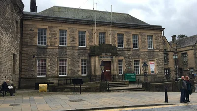
Town & sights
Linlithgow brings a palace, a loch and a historic town into one day.
Read this guide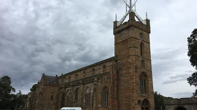
Parish church
St Michael's Church in Linlithgow, the historic parish church, stands by the palace approach.
Read this guide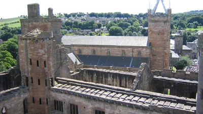
Things to do
Things to do in Linlithgow include the palace, town heritage, loch paths and canal.
Read this guide